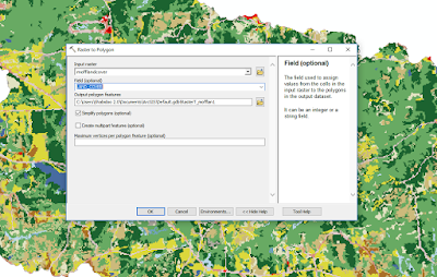
A land cover raster, but the cells are massive, and rather ugly.
First run Raster To Polygon. I recommend clipping the raster to whatever area you are working in because a state sized raster will take quite a while to convert to polygons. Before you hit run change the FIELD (optional) from Value to LAND_COVER. Now it will properly assign the polygons to the LAND_COVER attributes.
Next go to Properties -> Symbology -> Categories -> Unique values. In the Value Field drop down select LAND_COVER. If you have a style layer you can import it using the import button. If not you will have to manually change each color if you want to match the original raster. Or you can choose from a color ramp. The order of the values be changed by clicking on the value and using the arrows to the right to move them up or down (great if they are numeric values).
Here are the two side by side for comparison:
And using the Identify tool shows that they retained their LAND_COVER values, and it looks a whole lot better. Now spatial queries should be easier to do.


No comments:
Post a Comment